Tuesday, March 26, 2024

Drunk on Paleontology - Tricerahops Double IPA

The next Drunk on Paleontology is for Tricerahops Double IPA from the Ninkasi Brewing Company out of Eugene, OR.

Although, obviously named for the dinosaur Triceratops, the Ninkasi website also states that this beer, along with three others, are part of a comic series produced by Dark Horse Comics called Legend of Ninkasi: Rise of Craft.

And according to their comic lore:
Legend has it that Tricerahops, loyal companion to the goddess Ninkasi, acquires his abilities from the goddess’ mystical hops. While our brewery is working on propagating these hops for the good of all, we brewed this Double IPA to showcase all that’s possible. Its floral aromas collide with a splendor of resinous hop notes to create a beer suitable for a magical beast like Tricerahops himself.

Triceratops horridus skeleton and cast from the Field Museum in Chicago, IL. 

The first discovery of  material attributed to Triceratops, was in 1887 by George Lyman Cannon near Denver, Colorado, who had found a set of the brow horns attached to a skull roof. He sent the material to O.C. Marsh who, assuming the rock dates were Pliocene, determined that it was from a prehistoric bison, which he named Bison alticornis. However after a more complete specimen was discovered in 1888 from Wyoming's Lance Formation by John Bell Hatcher, as well as a couple of other discoveries, Marsh reevaluated the initial find and eventually added all the finds under a new species, Triceratops, which he named in 1889, meaning "three-horned face". 


The side of the Tricerahops box notes:
This is our monument to the big and beautiful beasts that came before us. Tricerahops is an ancient field of floral hops with a deep, earthy taste and a balanced finish.
Triceratops belongs to a group of animals known as ceratopsians.

Ceratopsian wall at the Natural History Museum of Utah. Triceratops is the one located in the far right at the top.

Ceratopsians were prolific during the Cretaceous, with many different varieties evolving with various numbers of horns and frill adornments. Triceratops was one of the last ceratopsians to have evolved with remains having been found in rocks dating from ~69 million years ago to the end of the dinosaurs ~66 million years ago. It is estimated that Triceratops could grow up to 30 feet in length and weigh 12,000-16,000 pounds. There are currently two recognized species of Triceratops, T. horridus (pictured above in Chicago) and T. prorsus


The skull of Triceratops is one of the largest skulls ever discovered, approaching 10 feet in length in some individuals and not only had the three primary horns (one above each eye and one on the snout), it also had a series of spikes along the edge of the frill known as epoccipitals, and hornlike projects on the jugals (cheekbones). The horns are thought to serve multiple functions, such as defense from predators as well mating display structures. 

Tuesday, March 19, 2024

Drunk on Geomorphology - Salt Flats Slipstream IPA


The next Drunk on Geology is for Salt Flats Slipstream Indian Pale Ale from the Salt Flats Brewing Company out of Salt Lake City, UT. 

For this post we'll focus on the name of the Brewing Company, Salt Flats. The Salt Flats Brewing Company from Salt Lake City is named after the nearby Bonneville Salt Flats, a large flat pan covered with a hard salt crust which lies to the west of the Great Salt Lake. 

The Bonneville Salt Flats

Although used as a race track in the dry season, the Bonneville Salt Flats have an extensive geological history. The formation of the salt flats started when this region of North America, known as the Basin and Range Province, started to form. At one point in time the western edge of North America was being compressed by the Farallon Plate pushing up against North America, squeezing the continent as the Farallon plate subducted (went beneath) North America.

Graphic of the Farallon Plate subducting beneath North America. Image courtesy of the NPS.

Eventually most of the Farallon Plate was entirely subducted beneath North America, especially along the Californian coast, and the compression was released. This essentially allowed North America to expand outwards, like a squeezed sponge being let go. This expansion thinned the crust, while also producing a series of linear mountain ranges and valleys. 

Graphic of the Basin And Range expansion producing linear mountains and valleys. Image courtesy of ISU.edu

As the expansion progressed, the crust was broken up into a series of smaller blocks. These blocks rotated as the crust stretched out. The rotation of the blocks produced the mountains along the upper corners, with gaps along the lower corners. These gaps eventually were filled with sediment eroded off the mountains, forming the valleys between the mountain ranged. 

Coverage of the Great Basin. Image courtesy of the NPS.

With the thinning of the crust, this area also ended up being lower than the surrounding regions. Because of this, water was not able to flow out of the Basin and Range Province, also known as the Great Basin. Unlike water along the eastern portion of the country and along the west coast, water within the Great Basin does not reach the oceans. All precipitation here eventually ends up in end- or terminal basins, such as the Great Salt Lake, where the only water outflow is through evaporation.

Where the Desert Meets the Mountains

The Great Basin currently contains many end-basins with the primary basin being the Bonneville Basin, which ends at the Great Salt Lake currently. However, during the last ice age the Great Salt Lake was much, MUCH, bigger. Referred to as Lake Bonneville, the lake covered most of western Utah as seen in the map below. 

Maximum extent of Lake Bonneville. Image courtesy of the Utah Geological Survey

Lake Bonneville started to form 30,000 years ago during the last Ice Age and reached its peak at 18,000 years ago. At that point it had reached it's physical maximum volume and started to overflow the glacial moraine dam that was located to the north at Red Rock Pass in Idaho. Once the water reached this level it spilled out over the top of Red Rock Pass. This spillage eventually caused the dam to collapse releasing a mega-flood on to the Snake River Plain. This mega-flood caused to lake level to drop by almost half within a matter of weeks. As the Earth slowly moved out of the Ice Age, the climate started to dry. This drying caused less precipitation within the basin and over time the water level dropped from the imbalance between precipitation and evaporation in the Great Basin. 


As the water in Lake Bonneville evaporated, salt that was dissolved in the fresh water lake started to concentrate. Each year several million tons of dissolved salts are added to Great Salt Lake basin from its tributary rivers. Most lakes worldwide have an outlet and therefore salts and other erodes chemicals don't concentrate within those lakes, being washed out as the water cycles through. However, in terminal lakes while the water is able to evaporate away, the salt is left behind, increasing the salt concentration year over year. 

Where the finish line meets hoppiness

After the water level of Lake Bonneville (which turned into the Great Salt Lake) dropped below the elevation of the Great Salt Lake desert, the Bonneville Salt Flats started to be born. Over time the salty groundwater wicked its way up to the surface, evaporated, and left the salt behind creating a thin crust of salt across the surface of the salt flats. Over time this thin layer of salt built up into a significant hard pan. In places the salt reaches several feet thick in the center of the salt flats and peters out towards the edges. Today these evaporative processes are help along by the addition of salt brine added to the salt flats from the nearby potash operations to prevent the too much salt from being removed from the area through industrial collection lakes. 

Friday, March 15, 2024

Drunk on Petrology - Greywacke Sauvignon Blanc


The next Drunk on Geology is for Greywacke Sauvignon Blanc from the Greywacke Winery in Marlborough, New Zealand.

The term "greywacke" (pronounced "grey wacky") is a rock name like sandstone or granite. However, the term is typically used as a "garbage" or "trash can" term, meaning that it is often used when better names aren't known. Greywacke is a grey sedimentary rocks composed of various cemented rock and mineral fragments like a sandstone or an arkose. While the term "greywacke" is often used without a specific meaning, there is a specific meaning to the term according to the Dictionary of Geological Terms 3rd Ed.:
Graywacke: (Note: this the the American spelling of the term "gray" for "grey") - An old term, now generally applied to a dark gray firmly indurated coarse-grained sandstone that consists of poorly sorted angular to subangular grains of quartz and feldspar, with a variety of dark rock and mineral fragments, embedded in a compact clayey matrix having the general composition of slate and containing an abundance of very fine-grained illite, sericite, and chlorite minerals. Graywacke commonly exhibits graded bedding and is believed to have been deposited by submarine turbidity currents. 
A piece of New Zealand greywacke. Image courtesy of The University of Auckland

Greywacke is a variety of argillaceous sandstone that is highly indurated and poorly sorted. It comprises a large percentage of the basement rock of New Zealand, and so is an important rock type throughout the country. Because it has been subjected to significant amounts of tectonic movement over a long period of time (some New Zealand greywacke is over 300 million years old), greywacke is commonly extremely deformed, fractured, and veined. Although greywacke can look similar to basalt, it differs in that it is commonly veined (with quartz being the vein mineral), and lacks vesicles.

Greywacke from New Zealand's Southern Alps. Image courtesy of teara.gov.nz

Here are New Zealand's Southern Alps, which are almost entirely comprised of the Torlesse greywacke. Some more information from the Greywacke website:
New Zealand does not have a designated national rock, but if one was ever chosen, it would have to be greywacke. This drab grey stone is found everywhere in New Zealand – on the mountains, in the rivers, on the beaches. It consists of layers of hard, muddy grey sandstone alternating with thinner layers of darker mudstone (argillite). Technically, the term greywacke refers to the sandstone (wacke is a German name for a type of sandstone), but it is also used as a general term for the entire rock. 
The label on the back of the bottle has a bit more geological context:
"Named after New Zealand's prolific bedrock, Greywacke (pron Greywacky) is the label of Kevin Judd, one of Marlborough's pioneer winemakers. Grown in prime vineyard sites in the central Wairau and Southern Valleys, this is a deliciously aromatic, finely balanced wine." 

More from the Greywacke website:
Greywacke (Grauwacke) was first used in the 18th century to describe rocks in the Harz Mountains of Germany. Ernest Dieffenbach, a German scientist who travelled widely in New Zealand between 1839 and 1841, was the first person to use it for local rocks. English geologists regarded greywacke as an uncouth foreign term, but it was adopted in Scotland. Archibald Geikie’s Text-book of Geology, published in 1903, gave descriptions of greywacke, and helped persuade New Zealanders that it was an appropriate term for their most widespread rock. In the 1960s, some geologists argued that the term greywacke was vague and imprecise. A subcommittee of the Geological Society recommended that it be dropped, but this was widely ignored. The term is possibly used more widely in New Zealand than anywhere else in the world.
Sets of turbidite deposits along the coast in Zumaia, Spain

As noted above, the greywacke "is believed to have been deposited by submarine turbidity currents". These submarine turbidity currents are also known as turbidites. Generally, these are underwater landslides. The landslides are denser than the surrounding water with the sediment tumbling down from higher to lower elevations. During the tumbling, sediment is kicked up into the surround water creating a "turbid" cloud. Once reaching a stable platform the cloud will settle out with the larger sediment fragments settling out first, followed by smaller and smaller sediments until the top layer is made up of a fine clay.  

As seen in the image above, when you have areas which are prone to turbidite deposits, these will often result in packets of rocks that cycle through that course to fine cycle. The above picture is from Zumaia, Spain where the rocks, once horizontal, have since been rotated almost vertically. 

Geologic Map of New Zealand. Image courtesy of Geologictimepics.com

Greywacke is a primary component of the Torlesse Composite Terrain of New Zealand. Looking at the above geologic map of New Zealand, we can see how much of the islands, especially the southern island, are covered with the Torlesse. And besides just these areas where it is exposed, the Torlesse is found below most of the younger rocks across the islands. The composition of the Torlesse Composite Terrain includes not only greywacke but also argillite, as well as metamorphosed rocks that were altered from the original greywacke and argillite.

The Torlesse Composite was deposited by submarine turbidites in deep marine water which ranges in age from Middle Permian (~260 million years old) to the Early Cretaceous (~100 million years old) with the primary deposition taking place in the Late Triassic, or approximately 216 million years old. 

Monday, December 6, 2021

Drunk on Geomorphology - Dead Horse Amber Ale


The next Drunk on Geology is for Dead Horse Amber Ale from the Moab Brewery in Moab, Utah. 

The first thing that sticks out about the beer is easily the name "Dead Horse", and although it is a grisly name, it is actually named after a geological feature nearby to the brewery, Dead Horse Point State Park, which is located outside of Moab near Canyonland National Park. The name of the park comes from a legend where cowboys would fence off wild mustang horses along the overlook, taking what horses they wanted and leaving the horses they didn't penned up to die of thirst. 

Above is an image taken from the overlook at Dead Horse Point State Park looking off towards the southeast. The river there is the Colorado River far below. Between us and the river lies 100 million years of geological history. From top (youngest) to bottom (oldest) the rock units go like this:

Entrada Formation: Jurassic (150 million years old) - This is a sandstone formed from a coastal dune environment. These are what the arches at Arches National Park are found in.

Navajo Sandstone: Jurassic (175 million years old) - Wind deposited, prehistoric "petrified" sand dunes from an ancient erg (sand sea), colored a light tan or white color. The units also preserve phenomenal cross bedding features from the sand dunes. These rocks form the majority of the rock formations in Zion National Park.

Kayenta Formation: Late Triassic (180 million years old) - A series of sandstones, shales, and limestones from a meandering river environment that frequently preserves dinosaur tracks. This formation is very well observed in the nearby Canyonlands National Park.

Wingate Sandstone: Triassic (200 million years old) - Like the Navajo, another wind deposited preserved series of sand dunes, however usually with more of a red tint to the rocks (rust). 

Chinle Formation: Triassic (210 million years old) - A stream deposited series of mudstone, sandstone, and conglomerates. Well known for containing uranium deposits, petrified wood, and fossils. You can see some of the ancient uranium mines in nearby Capitol Reef National Park.

Moenkopi Formation: Early Triassic (230 million years old) - A tidal flat deposited series of brown to red mudstones. The rocks will often feature ripple marks and raindrop imprints. You can see this formation especially well along the western entrance to Capitol Reef National Park.

Cutler Formation: Permian (250 million years old) - Comprised of sandstone and conglomerate, this formation was deposited along a coastal-marine beach with off-shore sands and non-marine alluvial floodplain deposits intermixed. The most notable feature of the Cutler is the White Rim Sandstone.

Honaker Trail Formation: Pennsylvanian to Permian (286-320) - Down at the level of the river lies this shallow sea deposit comprised of dark grey limestones with fossils. 


You'll note on the can though that is says "10 million years in the making" which is clearly not a reference to any of the rocks which are far older than 10 million years old. This is actually a reference to the location that this point is on, which is the Colorado Plateau. This region of the country has slowly been uplifted over the past 10 million years and the Colorado River at this overlook is a prime example of the effect of that uplift. 

Text on the side of the can:
"Dead Horse Ale is named after the scenic overlook near Arches National Park. A traditional English-style mild ale with a well balanced malt to hop ratio."
Around 10 million years ago the Farallon Plate, a large plate that was subducted below North America off the western coast of the the US, began to push upwards on the region. As the region was forced upward, the rivers that were formally allowed to meander naturally, started to erode downwards into the underlying bedrock. This downward erosion locked the rivers in place, creating a feature known as an entrenched meander. This entrenched meander is what created the "point" in Dead Horse Point, where an entrenched meander created the outcrop of rock jutting outwards.  

Monday, November 22, 2021

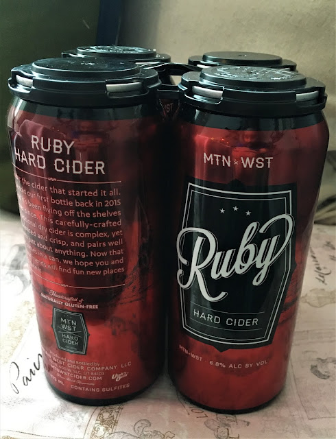
Drunk on Mineralogy - Ruby Hard Cider


The next Drunk on Geology is for Ruby Hard Cider from the Mountain West Cider Company

Although often referring to the strong red color, the ruby is a gemstone that comes in a pink to blood-red hue. The name "ruby" comes from the Latin ruber, meaning red. A ruby is the red variety of the mineral corundum, whereas all other colors of corundum are known as sapphires. Corundum itself is an aluminum oxide mineral, with the chemical formula of Al2O3

Ruby crystals from wikigempedia.com

Corundum is one of the hardest minerals on Earth and serves as the 9 index mineral on Mohs Hardness Scale (of which a diamond is 10). This high hardness means many things about the mineral, one of which is that it is very difficult to erode, often being left behind after the host rock has eroded away, but also that it can be used readily as an abrasive. Corundum also has a very high specific gravity (density), especially for a non-metallic mineral, making it fairly easy to identify. Corundum is frequently found as a metamorphic mineral in marbles, gneiss, and schists but can also be found in igneous rocks such as granite and nepheline syenite. 

Looking at the ruby specifically, the red color is created by the addition of small amounts of chromium into the crystal structure. The color can be variable though, depending on the amount of chromium and iron, with the colors themselves often ending up being region specific. Terms like "Burmese" ruby for those found in Myanmar or "Thai" ruby for those found in Thailand are then sometimes used, but the color is not always a great indication of source. 

Natural rubies, however, are extremely rare. And even when they are found, they are often imperfect specimens that require heating and chemical treatments to perfect them for gem purposes. Because of that, artificial rubies are more often used for gemstones. Artificial rubies had been produced for over 120 years and produce very high quality looking gems for a fraction of the cost. 

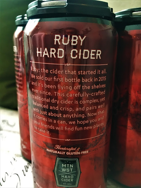
Text on the back of the can:
"Ruby: the cider that started it all. We sold our very first bottle back in 2015 and it's been flying off the shelves ever since. This carefully-crafted traditional dry cider is complex, yet balanced and crisp, and pairs well with just about anything. Now that it comes in a can, we hope you and your friends will find fun new places to take it."
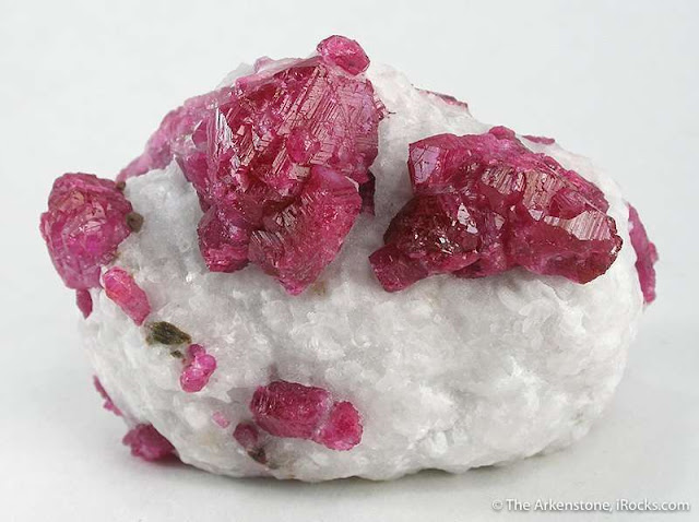
Rubies in marble from Vietnam. Image courtesy of irocks.com.

Historically, the places most well known for ruby deposits are in Asia, however they have been discovered well outside of Asia including Africa, Australia, and the United States. The most notable ruby deposits are in Myanmar, Sri Lanka, Thailand, Cambodia, Madagascar, Mozambique, Nepal, Afghanistan, and Vietnam. It is because of the rarity of the natural ruby, as well as the beauty that a perfect crystal possesses, that lends the natural ruby such a high price point, even if it had been heat-treated to remove flaws.

Wednesday, November 17, 2021

Drunk on Paleontology - Soul Rex Double IPA


The next Drunk on Paleontology post is for Soul Rex Double IPA by Level Crossing Brewing Company out of Salt Lake City, UT. 

The Soul Rex is clearly an homage to one of the mightiest of dinosaurs, the Tyrannosaurus rex. As pictured on the can, the logo presents a stylized version of the T. rex in shades, a jazz type hat, and holding a bass. I had previously done a couple of T. rex inspired beers before for the Pseudo Sue Pale Ale and the Tooth and Claw Dry Hopped Lager. Both of those beers focused on one specific T. rex skeleton, SUE, located at Chicago's Field Museum. So for this one I will look at the T. rex in general.


The first Tyrannosaurus rex skeleton was discovered in 1902 by Barnum Brown, the then assistant curator for the Department of Vertebrate Paleontology at the American Museum of Natural History (AMNH) in New York. The bones, discovered in the Hell Creek Formation near Hell Creek, Montana, were identified by a local land owner who then told Brown. The skeleton, only 10% complete, took 3 years to excavate and was then transported to the AMNH where the paleontology curator of the museum, Henry Fairfield Osborn, named the fossil in 1905 Tyrannosaurus rex, meaning "Tyrant Lizard King". 


All fossils of the T. rex have since been found in western North America, ranging from southern Canada down into southern New Mexico and Texas. The T. rex was also one of the last living non-avian dinosaurs, having lived during the late Cretaceous period from about 68 to 66 million years ago, which is when the meteorite struck the Earth, wiping out those non-avian dinosaurs.

Original mount of the T. rex. Image courtesy of the AMNH

Although the skeleton discovered initially by Brown was only a partial skeleton, an even more complete skeleton was discovered by Brown 6 years later that became the basis for the skeleton seen above, mounted at the AMNH. It is this mount that went on to influence pop-culture for most of the next hundred years, where the T. rex was almost always portrayed in a vertical pose. Unfortunately this pose was set up mostly because of the steel armature could not do a more dynamic pose. Many of the tail vertebrae even needed to be broken in order to get the T. rex to be standing like this. 


It wasn't until 1993's Jurassic Park, that movie and tv makers really started to take a look at the advancing science behind the dinosaurs and adjusted their models accordingly. For the movie, the T. rex is presented in a much more accurate model, where the body of the beast is balanced over the legs, with the tail acting as a counterweight, forming a giant see-saw. This remodeled T. rex also gives us a much more accurate depiction of its size, where an adult can grow up to ~12 feet tall at the hip and ~40 feet long from tip of the tail to snout. But one of the most notable features of a T. rex were its teeth, that ranged in size up to 12 inches long, which included the root, still leaving approximately a 6 inch tooth exposed.

Text from the back of the can:
Soul Rex Double IPA - A hefty but cultured pint. Sweet notes bellow from a cellar cabaret... you're unwavering to behold who's onstage... as your eyes come into focus in the dark dank chamber... just so you know, he's got soul! This badass beer has a deep golden hue exposing a sophisticated world of tropical fruit whiffs with melon and citrus as the opening act. For the encore, stone fruit and juicy hop bitterness steal the show. This beet performs as intended, a highly drinkable brew to enjoy again and again.
Since the release of Jurassic Park, the science of T. rex has continued to advance. With the discovery that birds are descendants of dinosaurs, and many dinosaurs discovered with feathers, it is now believed that even the T. rex likely sported some variety of plumage, although it is currently unclear how much plumage a T. rex  may have had at any given point in its life. 

It is unclear how much this current model of the T. rex will change as more fossils are discovered and analyzed, but as one of the most famous dinosaurs, there are sure to be many people hunting for the next big breakthrough. Will those future discoveries include that T. rexes liked to hang out in jazz clubs and play the bass? The world may never know.  

Sunday, November 14, 2021

Drunk on Geomorphology - Colterris Monumental Cabernet Sauvignon


The next Drunk on Geology is for Colterris Monumental Cabernet Sauvignon from the Colterris Winery in Palisade, CO. 

Colterris Monumental Cabernet Sauvignon features prominently the Balanced Rock of nearby Colorado National Monument. Balanced Rock, named on the bottle, is presented on the bottle by an absolutely striking picture of the rock being highlighted by, what I am assuming, is a sunrise. The picture is a painting by Colorado based artist John Lintott

Balanced Rock is part of the Wingate Sandstone, the dominant rock formation within Colorado National Monument. The Wingate Sandstone is Early Jurassic (~200 million years old) in age and was formed from eolian sandstone. This means that these rocks were sand dunes that were once part of a desert (eolian meaning "wind blown"). The rock is made up of nearly entirely of quartz sand grains glued together with a mineral known as calcite, or calcium carbonate. The Wingate also includes some slight amounts of iron oxide, otherwise known as hematite, or rust, which gives the rock it's characteristic yellowish-red hue. 

Over time, this formation was solidified from the sand dune into a sandstone. And then this sandstone was uplifted along with all of the other formations that lie both above and below it. These formations then started to undergo erosion, breaking down the rocks slowly over time through wind, water, dissolution of the cement, and frost action. Water works its way through natural joints, or fractures, in the rock. As the water works its way through the rock, it dissolves the calcite cement, much in the same way water dissolves the calcite of a cave. Then during the winter time, without the cement holding the rock together, the water freezes and expands, forcing the rock slightly apart. Over the course of many thousands and millions of years, that small degree of movement compounds and slowly the rock is broken up. Gravity then carries away the pieces broken off, slowly eating away at the cliff face. 

Differences in the bedding and joints in the formation preferentially direct the water into specific areas, creating isolated pieces of rock that withstand erosion better then other places. You can see the vertical joint along the right side of the rock that had preferentially been eroded, isolating the column of rock. This likely was sourced by water running off of the plateau that we can see the end of on the right hand side. With the separation of the Balanced Rock pillar from the plateau, water likely has more difficulty getting to the Balance Rock, and therefore prolongs its existence. 

Weathering/erosion also attacked the bedding plane below the the Balance Rock, which eroded more than the overlying ball of rock. This same bedding plane can be traced back to the cliff face itself, where that same layer was also eroded more than the overlying rock. It is likely that those weaker areas of the rock also have higher amounts of erodable minerals like clay. 

The question on the display asks the most pertinent question of "How will Balanced Rock eventually topple?" but they do make note to point out that Balanced Rock is a snapshot in time that we are privileged to be able to witness. 

References